
Schorbus topographic map
Interactive map
Click on the map to display elevation.
About this map
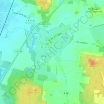
Name: Schorbus topographic map, elevation, terrain.
Location: Schorbus, Spree-Neiße, Brandenburg, Deutschland (51.68474 14.27406 51.68484 14.27422)
Average elevation: 94 m
Minimum elevation: 81 m
Maximum elevation: 120 m