
Albus topographic map
Interactive map
Click on the map to display elevation.
About this map
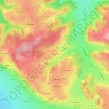
Name: Albus topographic map, elevation, terrain.
Average elevation: 815 m
Minimum elevation: 721 m
Maximum elevation: 887 m
Other topographic maps
Click on a map to view its topography, its elevation and its terrain.
Schorenmoos
Deutschland > Bayern > Landkreis Oberallgäu > Dietmannsried
Schorenmoos, Dietmannsried, Landkreis Oberallgäu, Bayern, 87463, Deutschland
Average elevation: 716 m