
Kampung Bukit Teruna topographic map
Interactive map
Click on the map to display elevation.
About this map
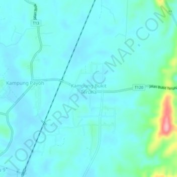
Name: Kampung Bukit Teruna topographic map, elevation, terrain.
Location: Kampung Bukit Teruna, Kemaman District, Terengganu, Malaysia (4.35776 103.39210 4.39776 103.43210)
Average elevation: 24 m
Minimum elevation: 3 m
Maximum elevation: 152 m
Other topographic maps
Click on a map to view its topography, its elevation and its terrain.
Sungai Kandang Rusa
Malaysia > Terengganu > Kemaman District > Kampung Semayor
Average elevation: 32 m