
Thank you for supporting this site ❤️
Make a donation
Make a donation
Gear up for your next adventure:
As an Amazon Associate, this site earns from qualifying purchases at no extra cost to you.
Dubbo topographic map
Click on the map to display elevation.
Thank you for supporting this site ❤️
Make a donation
Make a donation
Gear up for your next adventure:
As an Amazon Associate, this site earns from qualifying purchases at no extra cost to you.
About this map
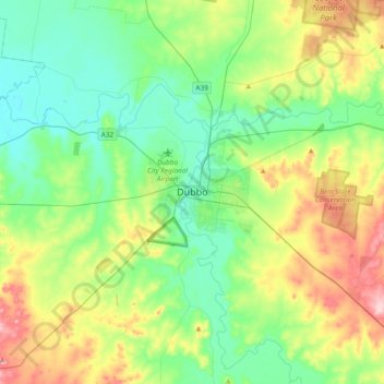
Name: Dubbo topographic map, elevation, terrain.
Location: Dubbo, Dubbo Regional Council, New South Wales, Australia (-32.40790 148.44265 -32.08790 148.76265)
Average elevation: 307 m
Minimum elevation: 244 m
Maximum elevation: 454 m
Thank you for supporting this site ❤️
Make a donation
Make a donation
Gear up for your next adventure:
As an Amazon Associate, this site earns from qualifying purchases at no extra cost to you.