
Tancanhuitz topographic map
Interactive map
Click on the map to display elevation.
About this map
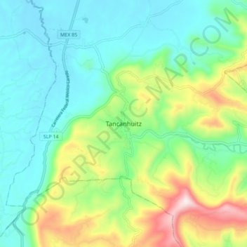
Name: Tancanhuitz topographic map, elevation, terrain.
Location: Tancanhuitz, San Luis Potosi, Mexico (21.55751 -99.00686 21.63751 -98.92686)
Average elevation: 229 m
Minimum elevation: 54 m
Maximum elevation: 664 m