
Los Carriles topographic map
Interactive map
Click on the map to display elevation.
About this map
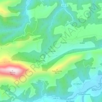
Name: Los Carriles topographic map, elevation, terrain.
Location: Los Carriles, Llanes, Asturies, Espagne (43.39398 -4.94962 43.43398 -4.90962)
Average elevation: 209 m
Minimum elevation: 34 m
Maximum elevation: 711 m
Other topographic maps
Click on a map to view its topography, its elevation and its terrain.