
Thank you for supporting this site ❤️
Make a donation
Make a donation
Gear up for your next adventure:
As an Amazon Associate, this site earns from qualifying purchases at no extra cost to you.
Collesanto topographic map
Click on the map to display elevation.
Thank you for supporting this site ❤️
Make a donation
Make a donation
Gear up for your next adventure:
As an Amazon Associate, this site earns from qualifying purchases at no extra cost to you.
About this map
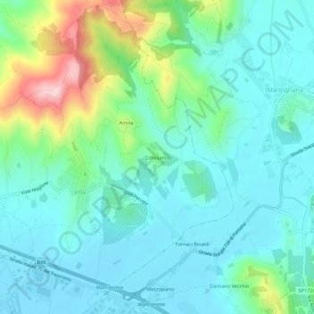
Name: Collesanto topographic map, elevation, terrain.
Location: Collesanto, Villa, Magione, Perugia, Umbria, 06063, Italy (43.13141 12.24419 43.17141 12.28419)
Average elevation: 295 m
Minimum elevation: 229 m
Maximum elevation: 520 m
Thank you for supporting this site ❤️
Make a donation
Make a donation
Gear up for your next adventure:
As an Amazon Associate, this site earns from qualifying purchases at no extra cost to you.