
Teller topographic map
Interactive map
Click on the map to display elevation.
About this map
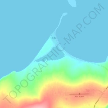
Name: Teller topographic map, elevation, terrain.
Location: Teller, Nome, Alaska, Estados Unidos de América (65.24260 -166.39443 65.27079 -166.28938)
Average elevation: 22 m
Minimum elevation: 0 m
Maximum elevation: 111 m