
Lamothe-en-Blaisy topographic map
Interactive map
Click on the map to display elevation.
About this map
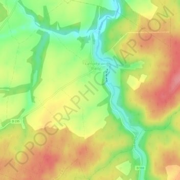
Name: Lamothe-en-Blaisy topographic map, elevation, terrain.
Average elevation: 311 m
Minimum elevation: 261 m
Maximum elevation: 355 m
La superficie de la commune est de 1 021 hectares ; son altitude moyenne est de 292 mètres.
Other topographic maps
Click on a map to view its topography, its elevation and its terrain.
Colombey-les-Deux-Églises
France > Grand Est > Haute-Marne > Colombey-les-Deux-Églises
Colombey-les-Deux-Églises, Chaumont, Haute-Marne, Grand Est, France métropolitaine, 52330, France
Average elevation: 318 m