
Bat Yam topographic map
Interactive map
Click on the map to display elevation.
About this map
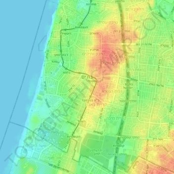
Name: Bat Yam topographic map, elevation, terrain.
Location: Bat Yam, Tel Aviv Subdistrict, Tel-Aviv District, Israel (31.99249 34.72875 32.03376 34.76194)
Average elevation: 21 m
Minimum elevation: -1 m
Maximum elevation: 52 m
Other topographic maps
Click on a map to view its topography, its elevation and its terrain.