Can Catí topographic map
Interactive map
Click on the map to display elevation.
About this map
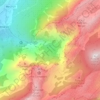
Name: Can Catí topographic map, elevation, terrain.
Average elevation: 618 m
Minimum elevation: 69 m
Maximum elevation: 1,070 m

Click on the map to display elevation.
Name: Can Catí topographic map, elevation, terrain.
Average elevation: 618 m
Minimum elevation: 69 m
Maximum elevation: 1,070 m