
Kruzof Island topographic map
Interactive map
Click on the map to display elevation.
About this map
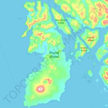
Name: Kruzof Island topographic map, elevation, terrain.
Location: Kruzof Island, Sitka, Alaska, USA (56.98960 -135.87736 57.34367 -135.56092)
Average elevation: 88 m
Minimum elevation: -3 m
Maximum elevation: 998 m
Other topographic maps
Click on a map to view its topography, its elevation and its terrain.