
Adlergletscher topographic map
Interactive map
Click on the map to display elevation.
About this map
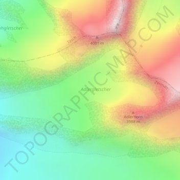
Name: Adlergletscher topographic map, elevation, terrain.
Location: Adlergletscher, Schwarzgrat, Täsch, Visp, Wallis, 3929, Schweiz (46.00697 7.85477 46.01950 7.89213)
Average elevation: 3,500 m
Minimum elevation: 2,993 m
Maximum elevation: 4,180 m
Other topographic maps
Click on a map to view its topography, its elevation and its terrain.
Findelgletscher
Findelgletscher, Schwarzgrat, Täsch, Visp, Wallis, 3929, Schweiz
Average elevation: 3,268 m