
Brook Valley topographic map
Interactive map
Click on the map to display elevation.
About this map
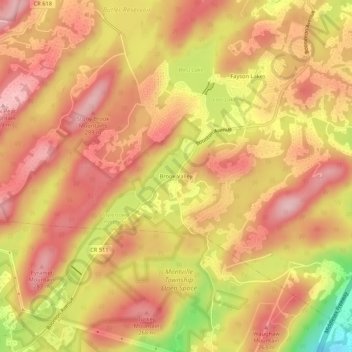
Name: Brook Valley topographic map, elevation, terrain.
Average elevation: 221 m
Minimum elevation: 92 m
Maximum elevation: 287 m
Other topographic maps
Click on a map to view its topography, its elevation and its terrain.
Jacksonville
United States > New Jersey > Morris County > Kinnelon
Jacksonville, Kinnelon, Morris County, New Jersey, 07444, United States
Average elevation: 110 m