
Aoanta topographic map
Interactive map
Click on the map to display elevation.
About this map
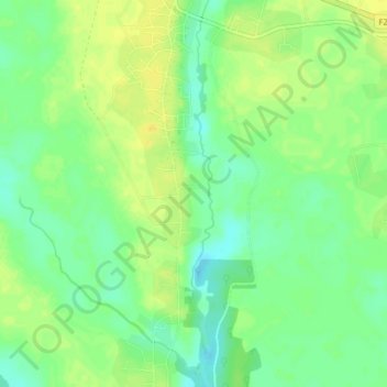
Name: Aoanta topographic map, elevation, terrain.
Location: Aoanta, Ikwerre, Rivers State, Nigeria (4.93846 6.86124 4.97846 6.90124)
Average elevation: 13 m
Minimum elevation: 1 m
Maximum elevation: 24 m