Geolocate

Fort Cobb topographic map

Click on the map to display elevation.

About this map
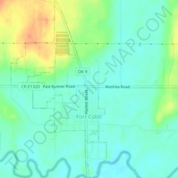
Name: Fort Cobb topographic map, elevation, terrain.

Location: Fort Cobb, Caddo County, Oklahoma, 73038, United States (35.08765 -98.45136 35.11696 -98.43209)

Average elevation: 390 m

Minimum elevation: 376 m

Maximum elevation: 419 m

Gear up for your next adventure:

🧼Biodegradable Soap - Leave-no-trace hygiene for multi-day mountain treks
🧦Merino Wool Hiking Socks - Moisture-wicking socks to prevent blisters during long mountain walks
❄️Walking Crampons - Added traction for icy slopes and winter peak bagging
🖼️Topographic Map Art - Decorative 3D-effect posters of famous UK peaks and regions
🔥Reusable Hand Warmers - Maintain dexterity in your fingers for precise map handling

As an Amazon Associate, this site earns from qualifying purchases at no extra cost to you.