
Thank you for supporting this site ❤️
Make a donation
Make a donation
Gear up for your next adventure:
As an Amazon Associate, this site earns from qualifying purchases at no extra cost to you.
Kichangani topographic map
Click on the map to display elevation.
Thank you for supporting this site ❤️
Make a donation
Make a donation
Gear up for your next adventure:
As an Amazon Associate, this site earns from qualifying purchases at no extra cost to you.
About this map
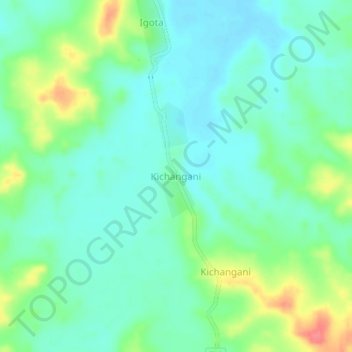
Name: Kichangani topographic map, elevation, terrain.
Location: Kichangani, Ulanga, Morogoro Region, Coastal Zone, Tanzania (-8.44273 36.66016 -8.40273 36.70016)
Average elevation: 323 m
Minimum elevation: 304 m
Maximum elevation: 370 m
Thank you for supporting this site ❤️
Make a donation
Make a donation
Gear up for your next adventure:
As an Amazon Associate, this site earns from qualifying purchases at no extra cost to you.