
Costa Teguise topographic map
Interactive map
Click on the map to display elevation.
About this map
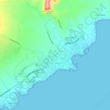
Name: Costa Teguise topographic map, elevation, terrain.
Location: Costa Teguise, Teguise, Las Palmas, Canary Islands, Spain (28.98256 -13.53202 29.01635 -13.47585)
Average elevation: 34 m
Minimum elevation: -4 m
Maximum elevation: 223 m