
Miaoshi topographic map
Interactive map
Click on the map to display elevation.
About this map
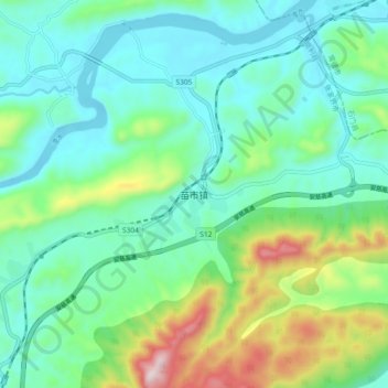
Name: Miaoshi topographic map, elevation, terrain.
Location: Miaoshi, Cili County, Zhangjiajie, Hunan, China (29.50654 111.20293 29.58654 111.28293)
Average elevation: 212 m
Minimum elevation: 59 m
Maximum elevation: 677 m