
Chiamberlando topographic map
Interactive map
Click on the map to display elevation.
About this map
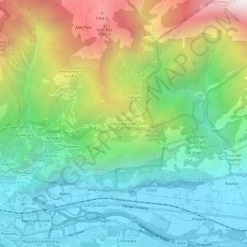
Name: Chiamberlando topographic map, elevation, terrain.
Location: Chiamberlando, Montpantier, Turin, Piémont, 10050, Italie (45.13154 7.07023 45.17154 7.11023)
Average elevation: 1,032 m
Minimum elevation: 448 m
Maximum elevation: 2,236 m