
Strezerberg topographic map
Interactive map
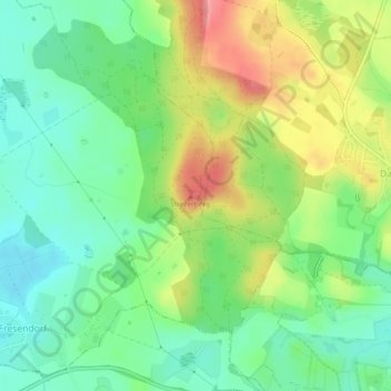
Click on the map to display elevation.
About this map
Name: Strezerberg topographic map, elevation, terrain.
Average elevation: 71 m
Minimum elevation: 34 m
Maximum elevation: 130 m
Other topographic maps
Click on a map to view its topography, its elevation and its terrain.
Giekau
Deutschland > Schleswig-Holstein > Giekau > Giekau
Giekau, Lütjenburg, Plön, Schleswig-Holstein, Deutschland
Average elevation: 50 m