
Rumelange topographic map
Interactive map
Click on the map to display elevation.
About this map
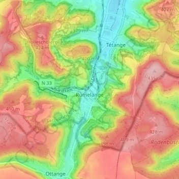
Name: Rumelange topographic map, elevation, terrain.
Location: Rumelange, Canton Esch-sur-Alzette, Luxembourg (49.44826 5.97875 49.47631 6.04363)
Average elevation: 367 m
Minimum elevation: 281 m
Maximum elevation: 441 m