
Make a donation
Gear up for your next adventure:
As an Amazon Associate, this site earns from qualifying purchases at no extra cost to you.
Arbouans topographic map
Click on the map to display elevation.
Make a donation
Gear up for your next adventure:
As an Amazon Associate, this site earns from qualifying purchases at no extra cost to you.
Arbouans
Arbouans est un petit village situé dans le Doubs (25) en Franche-Comté édifiée au pied de la route qui mène de Montbéliard à Audincourt sur la base du versant droit bordant la vallée du Doubs (rivière) largement étendue en plaine. La côte calcaire est à 330-340 m d'altitude et la plaine à 316 m.
Make a donation
Gear up for your next adventure:
As an Amazon Associate, this site earns from qualifying purchases at no extra cost to you.
About this map
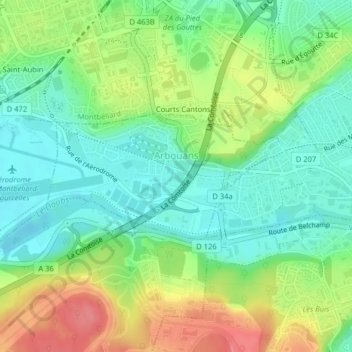
Name: Arbouans topographic map, elevation, terrain.
Average elevation: 340 m
Minimum elevation: 310 m
Maximum elevation: 388 m
Make a donation
Gear up for your next adventure:
As an Amazon Associate, this site earns from qualifying purchases at no extra cost to you.