
Fuenteheridos topographic map
Interactive map
Click on the map to display elevation.
About this map
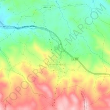
Name: Fuenteheridos topographic map, elevation, terrain.
Location: Fuenteheridos, Sierra de Aracena, Huelva, Andalusien, Spanien (37.88900 -6.68720 37.92446 -6.63881)
Average elevation: 712 m
Minimum elevation: 596 m
Maximum elevation: 853 m