Geolocate

Hamilton topographic map

Click on the map to display elevation.

About this map

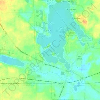
Name: Hamilton topographic map, elevation, terrain.

Location: Hamilton, Steuben County, Indiana, United States (41.52133 -84.93662 41.56363 -84.89937)

Average elevation: 283 m

Minimum elevation: 269 m

Maximum elevation: 306 m

Gear up for your next adventure:

📍Handheld GPS Navigators - Reliable satellite navigation for hiking and off-road exploration
📷Camera Straps - Secure straps for carrying cameras while walking
🦯Walking Poles - Supportive poles for long-distance walking
Camping Shelters - Emergency and lightweight shelters for outdoor use
📚UK Hiking Guidebooks - Detailed route descriptions for the Lake District, Peaks, and Highlands

As an Amazon Associate, this site earns from qualifying purchases at no extra cost to you.