Geolocate

Leap topographic map

Click on the map to display elevation.

About this map

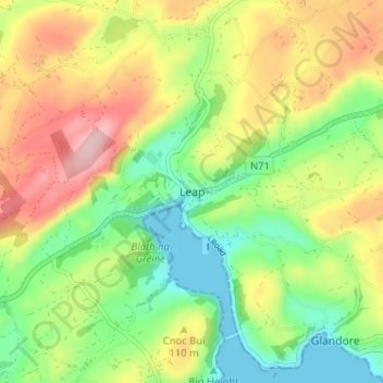
Name: Leap topographic map, elevation, terrain.

Location: Leap, West Cork, County Cork, Munster, P81RV10, Ireland (51.56106 -9.16334 51.60106 -9.12334)

Average elevation: 79 m

Minimum elevation: 0 m

Maximum elevation: 183 m

Gear up for your next adventure:

🥼Base Layers - Thermal base layers for temperature regulation
🌄Compact Monoculars - Lightweight optics for hiking
🧭GPS Trackers - Tracking devices for safety and navigation
🔦Outdoor Torches - Reliable torches for night navigation
📱Rugged Phone Cases - Heavy-duty protection for smartphones used as secondary GPS tools

As an Amazon Associate, this site earns from qualifying purchases at no extra cost to you.