
Reisdorf topographic map
Interactive map
Click on the map to display elevation.
About this map
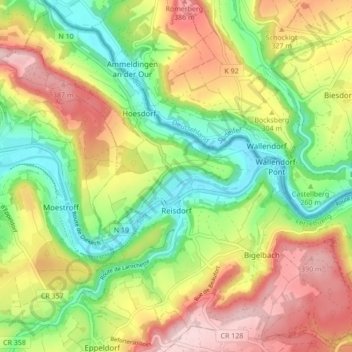
Name: Reisdorf topographic map, elevation, terrain.
Location: Reisdorf, Canton Diekirch, Luxembourg (49.84627 6.22866 49.89913 6.31433)
Average elevation: 284 m
Minimum elevation: 176 m
Maximum elevation: 414 m