
Kalemie topographic map
Interactive map
Click on the map to display elevation.
About this map
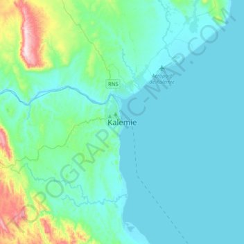
Name: Kalemie topographic map, elevation, terrain.
Location: Kalemie, Tanganyika, Democratic Republic of the Congo (-6.10602 29.03672 -5.78602 29.35672)
Average elevation: 847 m
Minimum elevation: 764 m
Maximum elevation: 1,409 m