
Sapa topographic map
Interactive map
Click on the map to display elevation.
About this map
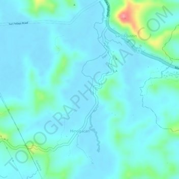
Name: Sapa topographic map, elevation, terrain.
Location: Sapa, Gandara, Samar, Eastern Visayas, 6706, Filippine (11.97767 124.80368 11.98178 124.80478)
Average elevation: 18 m
Minimum elevation: -1 m
Maximum elevation: 113 m
Other topographic maps
Click on a map to view its topography, its elevation and its terrain.
San Jose de Buan
Filippine > Samar > San Jose de Buan
San Jose de Buan, Samar, Eastern Visayas, Filippine
Average elevation: 299 m