Geolocate

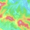
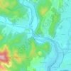
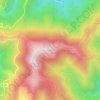
Junas topographic map

Click on the map to display elevation.

About this map

Name: Junas topographic map, elevation, terrain.

Location: Junas, Nîmes, Gard, Occitania, Metropolitan France, 30250, France (43.74013 4.09746 43.77771 4.14338)

Average elevation: 51 m

Minimum elevation: 15 m

Maximum elevation: 107 m

Other topographic maps

Click on a map to view its topography, its elevation and its terrain.

Esparon

France > Occitania > Gard > Bez-et-Esparon

Average elevation: 522 m

Mas Berthaud

France > Occitania > Gard > Saint-Gilles

Average elevation: 4 m

Les Mazes

France > Occitania > Gard > Village de Sérignac

Average elevation: 94 m

Les Brousses

France > Occitania > Gard > Molières-sur-Cèze

Average elevation: 293 m

Mont Aigoual

France > Occitania > Gard > Val-d'Aigoual

Average elevation: 1,355 m

la Croix

France > Occitania > Gard > Argilliers > Argilliers

Average elevation: 91 m

Escalade

France > Occitania > Gard > Sumène

Average elevation: 372 m

Camp Bernard

France > Occitania > Gard > Val-d'Aigoual > Fenouillet

Average elevation: 636 m

Le Soulier

France > Occitania > Gard > Saint-Martin-de-Valgalgues

Average elevation: 202 m

Bay

France > Occitania > Gard > Canaules-et-Argentières

Average elevation: 98 m

Le Fageas

France > Occitania > Gard > L'Estréchure

Average elevation: 854 m

Gear up for your next adventure:

👖Hiking Trousers - Durable trousers designed for rough terrain
🧺Ultralight Dry Bags - Organize and waterproof your gear inside your rucksack
📍Handheld GPS Navigators - Reliable satellite navigation for hiking and off-road exploration
🎒Multi-day Trekking Packs - Large capacity backpacks for wild camping and long-distance trails
🔦Outdoor Torches - Reliable torches for night navigation

As an Amazon Associate, this site earns from qualifying purchases at no extra cost to you.