
Tietjerksteradeel topographic map
Interactive map
Click on the map to display elevation.
About this map
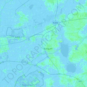
Name: Tietjerksteradeel topographic map, elevation, terrain.
Location: Tietjerksteradeel, Friesland, Nederland (53.12161 5.82964 53.28865 6.11459)
Average elevation: 0 m
Minimum elevation: -6 m
Maximum elevation: 11 m
Other topographic maps
Click on a map to view its topography, its elevation and its terrain.
Noardburgum
Nederland > Friesland > Tietjerksteradeel
Noardburgum, Tietjerksteradeel, Friesland, Nederland
Average elevation: 1 m