
Aïn Arnat topographic map
Interactive map
Click on the map to display elevation.
About this map
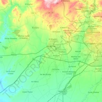
Name: Aïn Arnat topographic map, elevation, terrain.
Location: Aïn Arnat, Ain Arnat District, Setif, 19017, Algeria (36.09761 5.13341 36.25562 5.35076)
Average elevation: 1,010 m
Minimum elevation: 864 m
Maximum elevation: 1,346 m
due to its location on the High Plateaus at an elevation of 1,096 metres (3,596 ft), it is one of the coldest regions during winter in Algeria.It frequently sees an annual snowfall of up to 40 centimetres (16 in). Flash floods are rare but have recently occurred around the spring and fall seasons. The summer is fairly hot where extreme heat waves are common around the month of July where temperatures can sometimes even reach 40 °C (104 °F).