Geolocate

Lysos topographic map

Click on the map to display elevation.

About this map

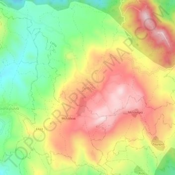
Name: Lysos topographic map, elevation, terrain.

Location: Lysos, Paphos District, Cyprus, 8800, Cyprus (34.97491 32.49201 35.01491 32.53201)

Average elevation: 470 m

Minimum elevation: 281 m

Maximum elevation: 655 m

Gear up for your next adventure:

🗺️Ordnance Survey Maps - Official UK maps for walking and outdoor activities
📷Camera Straps - Secure straps for carrying cameras while walking
🔦Outdoor Torches - Reliable torches for night navigation
🎒Hiking Daypacks - Compact backpacks ideal for short hikes and excursions
🔪Outdoor Multi-Tools - Versatile tools for gear repairs and food prep in the wild

As an Amazon Associate, this site earns from qualifying purchases at no extra cost to you.