
La Pesquera topographic map
Interactive map
Click on the map to display elevation.
About this map
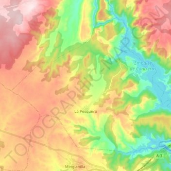
Name: La Pesquera topographic map, elevation, terrain.
Location: La Pesquera, Cuenca, Castilla-La Mancha, España (39.54376 -1.65034 39.63529 -1.50065)
Average elevation: 813 m
Minimum elevation: 616 m
Maximum elevation: 1,028 m