Geolocate

Philadelphia topographic map

Click on the map to display elevation.

About this map

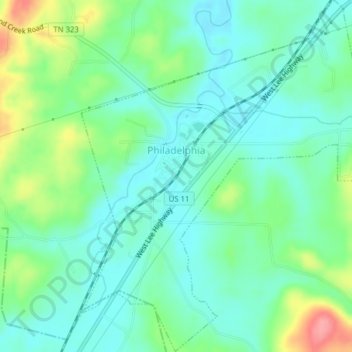
Name: Philadelphia topographic map, elevation, terrain.

Location: Philadelphia, Loudon County, East Tennessee, Tennessee, United States (35.66132 -84.41439 35.69305 -84.38326)

Average elevation: 279 m

Minimum elevation: 251 m

Maximum elevation: 348 m

Other topographic maps

Click on a map to view its topography, its elevation and its terrain.

Tellico Dam

United States > Tennessee > Loudon County

Average elevation: 243 m

Ford

United States > Tennessee > Loudon County

Average elevation: 285 m

Pine Grove

United States > Tennessee > Loudon County

Average elevation: 289 m

Busselltown

United States > Tennessee > Loudon County

Average elevation: 260 m

Luttrell

United States > Tennessee > Loudon County

Average elevation: 319 m

Bucktown

United States > Tennessee > Loudon County > Lenoir City

Average elevation: 258 m

Eaton Forest

United States > Tennessee > Loudon County

Average elevation: 297 m

Erie

United States > Tennessee > Loudon County

Average elevation: 310 m

Gear up for your next adventure:

🧰Survival Kits - Emergency tools for remote environments
Insulated Travel Mugs - Keep drinks hot while surveying the landscape from a summit
🔦LED Camping Lanterns - Illumination for reading maps inside your tent at night
🛌Insulated Sleeping Mats - Crucial thermal protection when sleeping on cold, uneven ground
👕Technical Hiking Tees - Moisture-management for high-exertion climbs

As an Amazon Associate, this site earns from qualifying purchases at no extra cost to you.