
Thank you for supporting this site ❤️
Make a donation
Make a donation
Gear up for your next adventure:
As an Amazon Associate, this site earns from qualifying purchases at no extra cost to you.
Yarhuay topographic map
Click on the map to display elevation.
Thank you for supporting this site ❤️
Make a donation
Make a donation
Gear up for your next adventure:
As an Amazon Associate, this site earns from qualifying purchases at no extra cost to you.
About this map
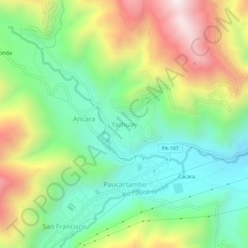
Name: Yarhuay topographic map, elevation, terrain.
Location: Yarhuay, Paucartambo, Pasco, Perú (-10.78492 -75.83355 -10.74492 -75.79355)
Average elevation: 3,220 m
Minimum elevation: 2,818 m
Maximum elevation: 3,880 m
Thank you for supporting this site ❤️
Make a donation
Make a donation
Gear up for your next adventure:
As an Amazon Associate, this site earns from qualifying purchases at no extra cost to you.