Geolocate

Fleurigny topographic map

Click on the map to display elevation.

About this map
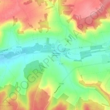
Name: Fleurigny topographic map, elevation, terrain.

Location: Fleurigny, Thorigny-sur-Oreuse, Sens, Yonne, Bourgogne-Franche-Comté, France métropolitaine, 89260, France (48.27181 3.34843 48.31181 3.38843)

Average elevation: 141 m

Minimum elevation: 87 m

Maximum elevation: 203 m

Other topographic maps

Click on a map to view its topography, its elevation and its terrain.

Gear up for your next adventure:

📐Altimeters & Barometers - Tools for measuring altitude and air pressure
🚶Walking Pedometers - Simple distance tracking for casual trail walkers
👖Hiking Trousers - Durable trousers designed for rough terrain
🪢Paracord - Multi-purpose cord for camping and survival
🧤Waterproof Overmitts - Extreme weather protection for hikers and mountaineers

As an Amazon Associate, this site earns from qualifying purchases at no extra cost to you.