
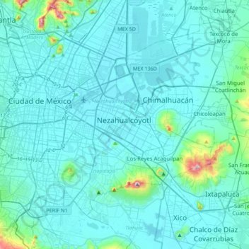
Nezahualcóyotl topographic map
Interactive map
Click on the map to display elevation.
About this map
Name: Nezahualcóyotl topographic map, elevation, terrain.
Location: Nezahualcóyotl, État de Mexico, 5700, Mexique (19.24790 -99.17815 19.56790 -98.85815)
Average elevation: 2,262 m
Minimum elevation: 2,222 m
Maximum elevation: 2,746 m