
Gachancipá topographic map
Interactive map
Click on the map to display elevation.
About this map
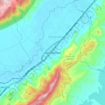
Name: Gachancipá topographic map, elevation, terrain.
Location: Gachancipá, Colombia (4.95203 -73.91211 5.03203 -73.83211)
Average elevation: 2,665 m
Minimum elevation: 2,547 m
Maximum elevation: 3,110 m