Geolocate

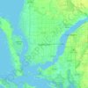
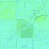
Ochos Rios Canal topographic map

Click on the map to display elevation.

About this map

Name: Ochos Rios Canal topographic map, elevation, terrain.

Location: Ochos Rios Canal, Cape Coral, Lee County, Florida, 33990, United States (26.60717 -81.95586 26.60745 -81.95313)

Average elevation: 4 m

Minimum elevation: 1 m

Maximum elevation: 5 m

Other topographic maps

Click on a map to view its topography, its elevation and its terrain.

Porto Vista

United States > Florida > Lee County > Cape Coral

Average elevation: 7 m

Cape Coral

United States > Florida > Lee County > Cape Coral

Average elevation: 3 m

Coral Lakes

United States > Florida > Lee County > Cape Coral

Average elevation: 6 m

Porto Vista

United States > Florida > Lee County > Cape Coral

Average elevation: 7 m

Gear up for your next adventure:

🕶️Polarized Sunglasses - Reduces glare from snow and water when reading terrain
🌄Compact Monoculars - Lightweight optics for hiking
❄️Walking Crampons - Added traction for icy slopes and winter peak bagging
🗺️Topographic Maps - Detailed maps showing elevation and terrain features
🧺Mesh Stuff Sacks - Breathable storage for wet gear or camp organization

As an Amazon Associate, this site earns from qualifying purchases at no extra cost to you.