Geolocate

Providence Bay topographic map

Click on the map to display elevation.

About this map
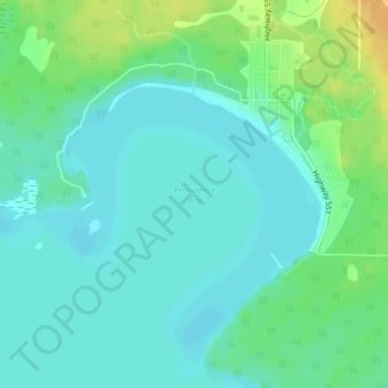
Name: Providence Bay topographic map, elevation, terrain.

Location: Providence Bay, Central Manitoulin, Manitoulin District, Northeastern Ontario, Ontario, P0P 1T0, Canada (45.66267 -82.27659 45.66277 -82.27649)

Average elevation: 180 m

Minimum elevation: 171 m

Maximum elevation: 199 m

Other topographic maps

Click on a map to view its topography, its elevation and its terrain.

Gear up for your next adventure:

🛌Insulated Sleeping Mats - Crucial thermal protection when sleeping on cold, uneven ground
📸Action Camera Chest Mounts - Record your ascent following topographic paths hands-free
🎒Replacement Sternum Straps - Repair parts for hiking rucksacks
🪢Paracord - Multi-purpose cord for camping and survival
🧺Mesh Stuff Sacks - Breathable storage for wet gear or camp organization

As an Amazon Associate, this site earns from qualifying purchases at no extra cost to you.