
Sherkala topographic map
Interactive map
Click on the map to display elevation.
About this map
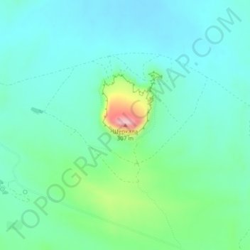
Name: Sherkala topographic map, elevation, terrain.
Location: Sherkala, Mangystau District, Mangystau Region, Kazakhstan (44.25476 52.00620 44.25486 52.00630)
Average elevation: 134 m
Minimum elevation: 87 m
Maximum elevation: 302 m
Other topographic maps
Click on a map to view its topography, its elevation and its terrain.
Aktau
Kazakhstan > Mangystau Region > Aktau
Aktau, Актау Г.А., Mangystau Region, 130000, Kazakhstan
Average elevation: -13 m
Mangystau District
Mangystau District, Mangystau Region, Kazakhstan
Average elevation: 72 m