Wilbur topographic map
Click on the map to display elevation.
Wilbur
Wilbur is situated in an oblong basin with Goose Creek, also named for Wild Goose Bill, running through the center of the town, and abrupt, basaltic cliffs, not of very great elevation, on the north and south. At one time this spot was, evidently, a lake. During the construction of U.S. Route 2, the course of Goose Creek was altered, moving its flow southward as it flows to the west, part of the Wilson Creek watershed.
About this map
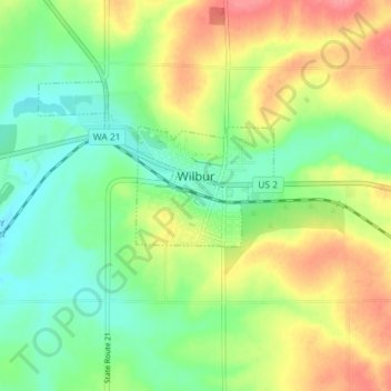
Name: Wilbur topographic map, elevation, terrain.
Location: Wilbur, Lincoln County, Washington, United States (47.74217 -118.76285 47.77035 -118.69133)
Average elevation: 680 m
Minimum elevation: 650 m
Maximum elevation: 722 m
Other topographic maps
Click on a map to view its topography, its elevation and its terrain.