
朝阳县 topographic map
Interactive map
Click on the map to display elevation.
About this map
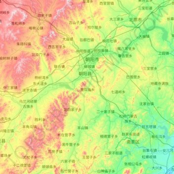
Name: 朝阳县 topographic map, elevation, terrain.
Location: 朝阳县, 朝阳市, 辽宁省, 中国 (40.92018 119.87569 41.90779 120.78510)
Average elevation: 341 m
Minimum elevation: 12 m
Maximum elevation: 1,123 m
Other topographic maps
Click on a map to view its topography, its elevation and its terrain.