
Jefferson topographic map
Interactive map
Click on the map to display elevation.
About this map
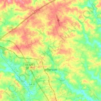
Name: Jefferson topographic map, elevation, terrain.
Location: Jefferson, Jackson County, Georgia, 30549, United States (34.07923 -83.67439 34.20015 -83.54486)
Average elevation: 248 m
Minimum elevation: 201 m
Maximum elevation: 307 m