
Federbettkees topographic map
Interactive map
Click on the map to display elevation.
About this map
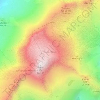
Name: Federbettkees topographic map, elevation, terrain.
Location: Federbettkees, 536, Finkenberg, Schwaz, Tyrol, 6295, Austria (47.08252 11.70333 47.08830 11.71326)
Average elevation: 2,728 m
Minimum elevation: 2,172 m
Maximum elevation: 3,205 m