
La Peyre topographic map
Interactive map
Click on the map to display elevation.
About this map
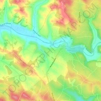
Name: La Peyre topographic map, elevation, terrain.
Average elevation: 230 m
Minimum elevation: 181 m
Maximum elevation: 282 m
Other topographic maps
Click on a map to view its topography, its elevation and its terrain.
Arzac
France > Occitanie > Tarn > Cahuzac-sur-Vère
Arzac, Cahuzac-sur-Vère, Albi, Tarn, Occitanie, France métropolitaine, 81140, France
Average elevation: 238 m