
Rätikon topographic map
Interactive map
Click on the map to display elevation.
About this map
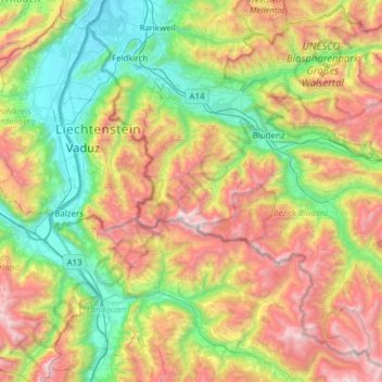
Name: Rätikon topographic map, elevation, terrain.
Location: Rätikon, Brand, Bludenz, Vorarlberg, Österreich (46.88194 9.47167 47.30019 9.96438)
Average elevation: 1,333 m
Minimum elevation: 423 m
Maximum elevation: 2,919 m
Other topographic maps
Click on a map to view its topography, its elevation and its terrain.
Schesaplana
Österreich > Vorarlberg > Brand
Schesaplana, Brand, Bludenz, Vorarlberg, Österreich
Average elevation: 2,445 m