
Retranchement topographic map
Interactive map
Click on the map to display elevation.
About this map
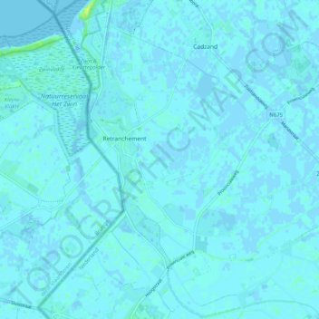
Name: Retranchement topographic map, elevation, terrain.
Location: Retranchement, Sluis, Zeeland, Nederland (51.31273 3.36290 51.37539 3.43496)
Average elevation: 1 m
Minimum elevation: -2 m
Maximum elevation: 14 m
Retranchement ligt in het zeekleipoldergebied op een hoogte van ongeveer 1 meter. Een nabijgelegen buurtschap is Terhofstede. De omgeving, waarin voornamelijk akkerbouw wordt bedreven, kenmerkt zich door oude, met knotwilgen omzoomde, polderdijken.
Other topographic maps
Click on a map to view its topography, its elevation and its terrain.