
Make a donation
Gear up for your next adventure:
As an Amazon Associate, this site earns from qualifying purchases at no extra cost to you.
Cracker Lake topographic map
Click on the map to display elevation.
Make a donation
Gear up for your next adventure:
As an Amazon Associate, this site earns from qualifying purchases at no extra cost to you.
About this map
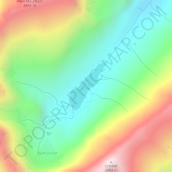
Name: Cracker Lake topographic map, elevation, terrain.
Location: Cracker Lake, Glacier County, Montana, United States (48.74033 -113.64820 48.74784 -113.63924)
Average elevation: 2,224 m
Minimum elevation: 1,735 m
Maximum elevation: 2,991 m
Make a donation
Gear up for your next adventure:
As an Amazon Associate, this site earns from qualifying purchases at no extra cost to you.
Other topographic maps
Click on a map to view its topography, its elevation and its terrain.
Cut Bank
United States > Montana > Glacier County
Cut Bank experiences a semi-arid climate (Köppen BSk), with long, cold, dry winters and short, warm, wetter summers. In winter, bitterly cold arctic air masses move south and impact the eastern side of the American Continental Divide. During such invasions, Cut Bank, with its comparatively high elevation and…
Average elevation: 1,147 m
Make a donation
Gear up for your next adventure:
As an Amazon Associate, this site earns from qualifying purchases at no extra cost to you.